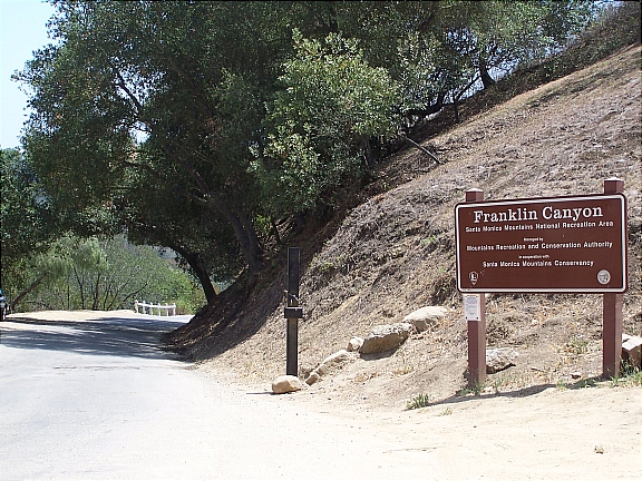
Located in Beverly Hills and part of the Santa Monica Mountains, Franklin Canyon Park provides a fantastic opportunity for hiking, picnicking, and breathtaking views of the city. This 600+ acre gem offers over 5 miles hiking along 3 major trails with various difficulty levels:
Discovery Trail
Easy (20 minutes / 0.3 miles): The easiest of the three, the Discovery Trail is a short loop that will take you about 20 minutes or less to complete. You can access the Discovery Trail from the southern entrance to the park.
Berman Trail
Easy/Intermediate (40 minutes / 1 mile): The Berman trail is about a mile in length and is moderately difficult. This trail connects to the northern entrance at Mulholland and provides for a scenic hike across the Santa Monica Mountains.
Hastain Trai
Intermediate (90 minutes / 2.3 mile): Although it’s the most popular trail at Franklin Canyon Park, the Hastain Trail is also the most strenuous. Gradually increasing as you make your way up trail, you’ll eventually reach a scenic overlook of the city; from here you can enjoy panoramic views of West Los Angeles and the Pacific Ocean.
Getting Here
There are two access points that feed into Franklin Canyon Park – one from the south and one from the south
From The South (Los Angeles-Beverly Hills): Travel north along Beverly Dr (towards Coldwater Canyon). Make sure you pay attention to the signs because you’ll have to turn left in order to continue along N Beverly Dr (otherwise, you’ll head up Coldwater Canyon). As soon as you reach Fire Station No. 2, keep your eyes open for Franklin Canyon Dr – it’ll be the third street on your right. Make a right turn onto Franklin Canyon Dr and then take the road until you reach the park entrance at Lake Dr.
From The North (San Fernando): To northern entrance can be accessed via Franklin Canyon Dr from the Mulholland Dr & Coldwater Canyon Intersection – you’ll see a sign that reads, “Road Closed 800 Feet. Sunset to Sunrise”. From here, simply follow the paved road until you reach the Sooky Goldman Nature Center. Alternatively, you can continue about 1.5 miles along Franklin Canyon Dr until you reach the southern entrance at Lake Dr.
Parking
Parking is available at Franklin Canyon Ranch (southern entrance), along Lake Dr, or at the Sooky Goldman Nature Center (northern entrance).
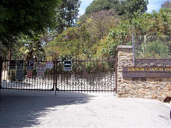
Located only a few blocks from Hollywood Blvd and extending North to Mulholland Dr, Runyon Canyon Park is a one of the city’s best kept secrets. The 130 acre urban wilderness offers ample opportunities for hiking, with a variety of trails available to suit both the novice hiker and those looking for something a little more challenging. Runyon Canyon is also known for its breathtaking views of the city which can be seen from about a half dozen viewpoints throughout the park. Depending on which direction you’re facing, you’ll be able to get a pretty good view of the Griffith Observatory, Hollywood sign, downtown Los Angeles, the Pacific Ocean, and the Sunset Strip.
Getting Here
There are only three access points that feed into Runyon Canyon Park – two from the South and one from the North. If you’re coming in through the South, you can enter from either Vista St or Fuller Ave; both entrances are only 2 blocks North of Hollywood Blvd. If you prefer to access from the North, there’s an entrance from Mulholland Dr.
The Trails – From The North
Easy (30 minutes / 0.5 miles): Entering from Mulholland Dr, take the trail leading to Indian Rock, the highest point in Runyon Canyon with spectacular 360 degree views of the city. This trail is about a half-mile in length each way.
Intermediate (90 minutes / 2.45 miles): Entering form Mulholland Dr, take the Western High Way route at the split and head up to High Point (0.7 miles); it’s the second highest point viewpoint in the canyon and provides an excellent view of the South and West. Afterwards, you’ll continue down Western High Way (0.5 miles) and then come back up the Central Fire Road to Mulholland Dr (1.25 miles).
The Trails – From The South
Easy/Intermediate (45 minutes / 1.6 miles): Entering from either Fuller Ave or Vista St, head up the Central Fire Road and around the East Ridge until you reach the Cloud’s Rest Viewpoint (0.85 miles). Spend a little time enjoying the scenery and then head down the slope and steps to yet another viewpoint, Inspiration Point (0.3 miles). Afterwards, you’ll simply take the Lower Fire Road back down to Fuller Ave (0.45 miles).
Intermediate (90 minutes / 2.15 miles): Entering from the Vista St, take the Western High Way route up to High Point (0.5 miles) for some excellent views of the city. Afterwards, you’ll continue your hike until you reach the Central Fire Trail (0.55 miles) and then make your way back down to where you started (1.1 miles). Before coming down the Central Fire Trail, you’ll have an opportunity to make your way up to Indian Rock (0.4 miles). This viewpoint offers panoramic views of the city and is the highest point in the park.
If you’re looking to enjoy a spectacular view of the Pacific Coastline and don’t mind a little hiking, head out to Point Dume State Beach in Malibu.
The hike to the coastal bluff atop Point Dume is really scenic and you can probably catch a good glimpse of the local wildlife. If you go up there between December and March, you may actually be able to spot some Pacific Gray Whales as they make their way to Baja California. On a warm day, you'll also have an opportunity to take a little dip in the tide pool which can be accessed from the eastside of the bluff.
You can make your way to the top of Point Dume by way of an ascending trail which begins at the end of Westward Beach Rd.


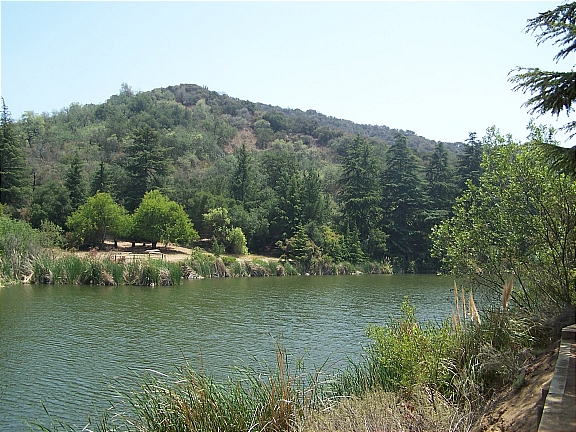 Located in Beverly Hills and part of the Santa Monica Mountains, Franklin Canyon Park provides a fantastic opportunity for hiking, picnicking, and breathtaking views of the city. This 600+ acre gem offers over 5 miles hiking along 3 major trails with various difficulty levels:
 If you’re looking to enjoy a spectacular view of the Pacific Coastline and don’t mind a little hiking, head out to Point Dume State Beach in Malibu.