
← PlanJam.comArchived blog, 2007–2008

Los Angeles Metro - PlanJam.com

From your screen to the scene

Category: Picnic Spots

A Winter's Hike to Switzer Falls

by Patricia Lamkin

If you enjoy hiking, and you want an out of the way romantic adventure with a like-minded friend, you'll find it deep in Angeles National Forest on the rugged trails of Switzer's Falls.

Part of the Upper Arroyo Seco River Basin, Switzer's is located off the Angeles Crest Highway, seven miles north of interstate 210 above La Canada/Flintridge. The shady trail head features picnic tables, charcoal grills, and restrooms situated along a gurgling, stony creek. Switzer's offers beginner to advanced trails, sunny mountain views, cool wooded glades, and the highlight of it all: the falls!

Fall and winter hikes are some of the best in these mountains, especially after a swell of rain has replenished the creek. This is when the falls are the most spectacular (during the hottest droughts of summer they can dwindle down to a meager trickle.) But elevations here range from 1,200 to 10,064 feet, and that means it’s always much cooler than L.A. The views are spectacular, but wear warm layers under your coat and something over your ears. A cuddling companion is also highly recommended!

To get there take the 210 to the Angeles Crest Highway exit, (State Route 2), going north. To park you will need a National Forest Daily Adventure Pass (one per vehicle). These can be purchased for $5.00 at the Shell station on Angeles Crest Highway, near the junction for the 210. Continue north on Route 2 another seven miles up the mountain.

You'll pass a small ranger station on your right, (another place to buy an Adventure Pass), and shortly after you'll turn right at Mile Marker 34.2. This is the Switzer Picnic Area.

The hours posted at the gate are 6 am to 10 pm. Signs indicate that the gate is locked at 6:00 pm, but you will still be able to exit the park if you stay after dark. Drive down the curvy spur road to the parking area at the bottom. Take the footbridge over the creek, and you are on your way to the falls!

For the first leg, the trail follows the creek, and occasionally the trail will seem to end. When this happens, cross the creek and the trail picks up on the other side. The creek crossings are man-made but natural - large strategically placed rocks or logs.

Eventually the trail will seem to dead-end at a natural stone wall. Follow the signs to Switzer Falls, which points you to a railed footpath that zigzags up the rock face. Leaving the creek, take this to the top and continue on the trail. The trail will start going down into the canyon, and eventually will meet back up with the creek, which now becomes the trail. Follow the rocky creek-bed upstream until you reach the falls.

After your hike, check out the rustic and relaxed village of La Canada Flintridge. Warm up with a hot drink at Zeli's Coffee Bar at 639 Foothill Blvd. If you’re hungry, go up a block to the Dish restaurant. The cozy fire and all American cuisine make for a nice ending to a romantic winter's day.
Elysian Park

by Ron

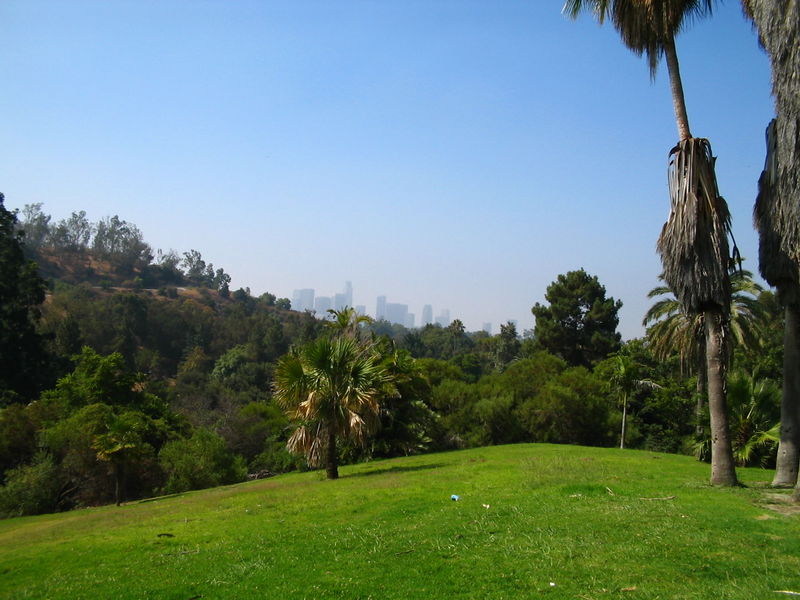
Elysian Park In Los AngelesThe second largest park in Los Angeles is the city's oldest, Elysian Park. Founded in 1781 by the Felipe de Neve, the Spanish California governor, the land originally encompassed over 17,000 acres. Today, the park is situated on 575 acres and is rich with historical sites, hiking trails, and national landmarks.

Since the park is so large, there are numerous activities to engage in. However, many find that the plentiful hiking trails offer some of the most beautiful scenic views throughout all of Los Angeles. There are plenty of picnic areas and barbecue pits in addition to the hiking and walking trails. Some of the features of Elysian Park include the Buena Vista Meadow Picnic Area, the Portola Trail Historical Monument, Solano Canyon where the community garden is located, and the Victory Memorial Grove, where the WWI Memorial is situated).

In addition to the hiking trails, the Elysian Park Therapeutic Recreation Center has outdoor seating and is designed to hold up to 300 people. There is a therapeutic program available for children and teens. There are also several barbecue pits as well as basketball courts and an indoor gym that has weights for working out.

The Montecillo De Leo Politi Park is commonly referred to as the Old Lodge and has many hiking trails as well. Located inside of Elysian Park, Montecillo De Leo Politi Park is open Monday through Friday from dawn to 3:00 P.M. Saturdays and Sundays, it is open from Dawn to Dusk. You'll find plenty of barbecue pits and picnic tables for your family events, but it is best to make reservations beforehand. They also have unlighted tennis courts. To make reservations for park use call: (213) 485-1310.

Roxbury Park In Beverly Hills

by Ron

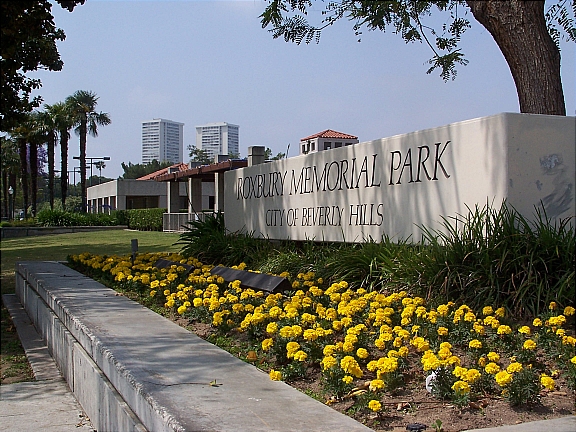
Roxbury Park in Beverly HillsLocated in the heart of Beverly Hills is a wonderful treasure: Roxbury Park. Roxbury Park is the perfect get away for those who would just like to take an afternoon to relax, use the grill, or rest under the shade of the canopy trees, Roxbury Park also provides plenty of activities for children, adults, and seniors. Whether it is taking a new class, learning a new sport, or simply enjoying the beauty of California, Roxbury Park is sure to please.

Athletics

For those seeking an athletic outlet, Roxbury Park offers many top of the line choices. There is a baseball field that also serves as a soccer field, 1 ½ basketball courts, 4 lighted tennis courts that rival those in the finest country clubs, and sand volleyball courts that are sure to provide hours of entertainment. The lush green hills look as if they roll endlessly and are the perfect backdrop for croquet and lawn bowling. If you’ve never played lawn bowling, don’t worry, the park also provides free classes, so all are invited to join in the fun.

Children At The Park

The children will love the large playground that features a pirate theme, and young children will enjoy playing in the designated toddler area. Preschool classes for children, such as Mommy and Me, community based senior activities, and adult classes are abundant. Some of the choices include yoga, creative writings, sculpting and other art related classes, as well as theater. The park also provides lunches for seniors between 11:15am to 12:15pm for $1.75.

Parties & Special Gatherings

Roxbury Park is the perfect place to host family reunions, special gatherings, or birthday parties. You must call ahead and reserve grills and picnic tables before your event. A permit may also be required so make sure to leave plenty of time before your function to get everything in order.

Park Rules

Be sure to read the rules before planning your trip to the park. Some of the rules include: making sure that dogs are kept on a leash no longer than six feet, no alcohol, smoking, or narcotics, children must be supervised; especially around water areas, and there are no bikes, skateboards, skates, or scooters allowed in the park.

Parking

Parking is metered, so be sure to bring plenty of change.

Will Rogers State Historic Park

by Ron

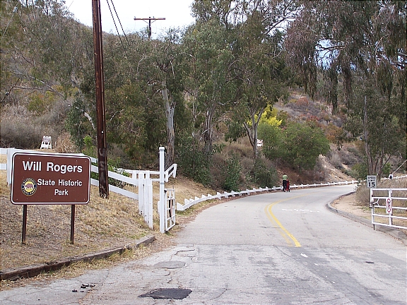
Will Rogers State Historic Park - EntranceLocated in the Pacific Palisades, Will Rogers State Historic Park is one of Los Angeles’s best kept secrets. One of the most popular and highest paid actors of his time, Will Rogers purchased this 186-acre property during the 1920’s as a retreat for his friends and family. An avid rider and horse fanatic, Will Rogers built an expansive ranch which included a 31-room ranch house, stable, corrals, riding ring, and a polo field. In 1935, Will Rogers was the victim of a tragic plane crash, and following his wife’s death in 1944, the ranch was converted into a State Park.

One of the most popular activities to enjoy at Will Rogers State Historic Park is hiking. Take the easy/moderate 3-mile trail loop up to Inspiration Point where you’ll be able to enjoy breathtaking views of downtown Los Angeles, Santa Monica, and the Pacific Coast. If you’re looking for something a little more challenging, head up along the Backbone Trail into the Santa Monica Mountain. The trail offers a fantastic opportunity for mountain biking, horseback riding (BYOH – Bring Your Own Horse), and hiking – leading you as far as Point Mugu State Park in Malibu.

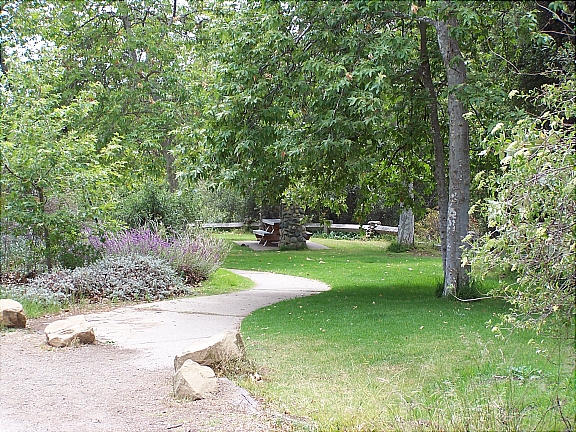
Will Rogers State Park is also popular for picnicking – there is tons of green space available for you to set up and enjoy picnic (first picture below).

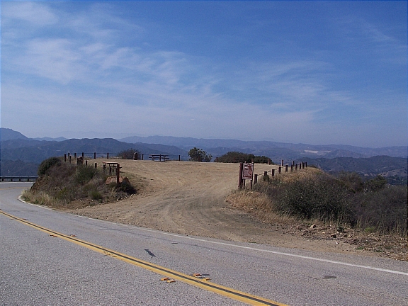
For something completely different, head up to the park on the weekends for an exciting polo match. The polo field (second picture below) is the only regulation size field in Los Angeles County; in fact, it’s the only polo field period. During the season (April through October), the Will Rogers Polo Club holds matches on Saturday – from 2pm to 5pm, and Sunday – from 10am to 1pm. The matches are absolutely free to the public, so if you’ve never seen a game of polo in person, make sure to come by and check it out.

Getting Here

Getting to the park is quite simple. Take Sunset Blvd westbound towards Pacific Palisades and make a right on Will Rogers State Park Rd. You’ll take the road for about half a mile until you reach the park entrance. Entrance to the park is free but there is a $7 fee for parking.

Piuma Lookout In Malibu: Part 1

by Ron

Piuma Overlook In MalibuIf you’re in the mood for a little drive, head up along Piuma Rd in Malibu for a breathtaking experience. The drive up to the lookout is exceptionally charming; you’ll enjoy picturesque views of the Pacific Coastline as you traverse the windy road. There are quite a few spots along Piuma Rd to take in a view, but there are two that I am particularly fond of. The first one, which will be discussed in this post, is a large dirt area overlooking the canyons. The other spot is a little more secluded and does require a little more effort to get to.

Once you reach the overlook, you can park your car on the dirt area. There are two large picnic tables available so feel free to bring along some food or even a board game. I strongly suggest that you take a warm sweater or coat with you because it does tend to get a little breezy up there.

Getting Here

You can get to the overlook from either Calabasas or Malibu. If you’re headed from Malibu, travel eastbound along Malibu Canyon Rd and make a right on Piuma Rd. Alternatively, if you’re coming from Calabasas, go westbound along Las Virgenes Rd and make a left on Piuma Rd.

Once you’re on Piuma Rd, you’ll drive for about 10 minutes until you reach a large dirt area which overlooks the canyons. Since there are no cross-streets on the way up, you’ll have to just keep your eyes open. The overlook will be on your left side as you come around the bend (click here for a map) and you’ll also be able to see it above you as you’re coming up Piuma Rd.

Temescal Gateway Park

by Ron

Temescal Gateway Park - Pacific PalisadesLocated in the Pacific Palisades, Temescal Gateway Park covers over 140-acres of terrain and is one of the most popular of the Santa Monica Mountain parks. The park offers ample opportunities for picnicking, panoramic views of the coastline, large grassy areas, and access several hiking trails that range from easy to moderate difficulty. You can also access additional hiking trails into Topanga State Park and Will Rogers State Historic Park.

Parking is available at the park entrance for $5 per day. The parking lot is a haven for parking enforcement so make sure that you follow all the rules. Also, make sure to watch your speed and come to a complete stop when necessary; the forest rangers are always on the prowl and they won’t hesitate to give you a citation. By the way, failure to come to a “complete” stop will run you about $100 (this comes from experience).

Alternatively, you can skip the parking fee and park along Temescal Canyon Rd or Sunset Blvd for free; just make sure to read the signs before heading up to the park. Also, if you’re coming here for the hike, make sure that you bring plenty of water along with you…there are no water fountains along the trails.

Getting Here

Getting to Temescal Gateway Park is really simple. If you’re taking PCH, turn onto Temescal Canyon Rd and head up about 1 mile until you reach Sunset Blvd…the park will be directly in front of you. If you’re taking the streets and are headed westbound along Sunset Blvd, you’ll make a right turn into the park at Temescal Canyon Rd.

San Vicente Mountain Park

by Ron

Located in the eastern portion of the Santa Monica Mountains, the 10-acre San Vicente Mountain Park offers access to an expansive network of trails for hiking and mountain biking, several picnic areas, and breathtaking 360-degree views of the city.

Interestingly enough, San Vicente Mountain Park was once used as a missile launch site during the Cold War (from 1956-1968). That explains the Nike-Ajax anti-aircraft structure and radar tower; both are no longer operational but the radar tower is an excellent spot from which you can enjoy a spectacular sunset.

Getting Here

Getting to the park is fairly simple. If you’re taking the freeway, take the 405 North and exit on Skirball Center Dr. Turn left onto Skirball Center Dr and then make another left on Mulholland Dr. As you’re heading east along Mulholland Dr, you’ll notice a dirt road on your left side…turn onto that road and head up the unpaved trail. The physical address is 17500 Mulholland Dr, but the nearest cross street to the park entrance is Canyonback Rd.

You can either park your car immediately on the right or continue a little further till you reach the parking lot. Once you park your car, there is a short 10-minute walk up to the park along a wide dirt road.

Note: The unpaved road is extremely bumpy and there are tons of rocks. If you have low profile tires, there is a chance that you may damage them.

Hiking At Franklin Canyon Park

by Ron

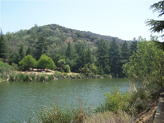
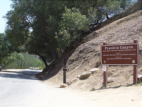
Franklin Canyon Lake Located in Beverly Hills and part of the Santa Monica Mountains, Franklin Canyon Park provides a fantastic opportunity for hiking, picnicking, and breathtaking views of the city. This 600+ acre gem offers over 5 miles hiking along 3 major trails with various difficulty levels:

Discovery Trail

Easy (20 minutes / 0.3 miles): The easiest of the three, the Discovery Trail is a short loop that will take you about 20 minutes or less to complete. You can access the Discovery Trail from the southern entrance to the park.

Berman Trail

Easy/Intermediate (40 minutes / 1 mile): The Berman trail is about a mile in length and is moderately difficult. This trail connects to the northern entrance at Mulholland and provides for a scenic hike across the Santa Monica Mountains.

Hastain Trai

Intermediate (90 minutes / 2.3 mile): Although it’s the most popular trail at Franklin Canyon Park, the Hastain Trail is also the most strenuous. Gradually increasing as you make your way up trail, you’ll eventually reach a scenic overlook of the city; from here you can enjoy panoramic views of West Los Angeles and the Pacific Ocean.

Getting Here

There are two access points that feed into Franklin Canyon Park – one from the south and one from the south

    From The South (Los Angeles-Beverly Hills): Travel north along Beverly Dr (towards Coldwater Canyon). Make sure you pay attention to the signs because you’ll have to turn left in order to continue along N Beverly Dr (otherwise, you’ll head up Coldwater Canyon). As soon as you reach Fire Station No. 2, keep your eyes open for Franklin Canyon Dr – it’ll be the third street on your right. Make a right turn onto Franklin Canyon Dr and then take the road until you reach the park entrance at Lake Dr.

    From The North (San Fernando): To northern entrance can be accessed via Franklin Canyon Dr from the Mulholland Dr & Coldwater Canyon Intersection – you’ll see a sign that reads, “Road Closed 800 Feet. Sunset to Sunrise”. From here, simply follow the paved road until you reach the Sooky Goldman Nature Center. Alternatively, you can continue about 1.5 miles along Franklin Canyon Dr until you reach the southern entrance at Lake Dr.

Parking

Parking is available at Franklin Canyon Ranch (southern entrance), along Lake Dr, or at the Sooky Goldman Nature Center (northern entrance).

Additional Images (click to enlarge)

El Matador State Beach: Malibu

by Ron

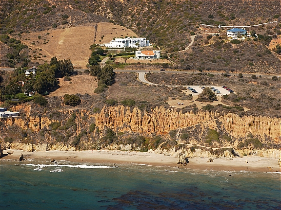
El Matador State Beach in MalibuLocated in Malibu, El Matador State Beach is a small and secluded strand of beach which offers visitors a fantastic escape from the bustling of city life. This local gem is one of three “pocket beaches” that make up the larger Robert H. Meyer Memorial SB – situated along Pacific Coast Highway between Point Dume and Leo Carrillo. It’s not the easiest beach to find, but you’ll appreciate making the extra effort once you finally get there. Lined with gentle white sand and picturesque views, the El Matador shoreline is home to an exquisite series of rock formations and shallow caves for you to explore.

Unless you arrive on a busy summer weekend, chances are you’ll have a good piece of the beach all to yourself. Take this opportunity to bring along someone special for a romantic picnic or to enjoy a spectacular sunset – or both. Alternatively, the solitude of El Matador offers the perfect getaway after a long and stressful week.

The beach also offers fantastic views of the Pacific coastline and it’s great for swimming and/or sunbathing. If it's not a busy summer day, there will be no lifeguard on duty so try to be careful out there.

Getting Here

Getting to El Matador State Beach can be a tad difficult and it does require a little hiking along a steep dirt trail. Therefore, it’s probably not the best places for children and it’s pretty much inaccessible for the handicapped.

If you can’t find any spots along PCH, there is a paid parking lot at the top of the bluff with a path leading to the beach. Parking is $4 and you can obtain your pass from the meter box.

*Photograph courtesy of California Coastal Records Project

Picnicking In The Pacific Palisades

by Ron

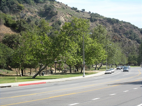
Temescal Canyon Road in the Pacific PalisadesTrying to figure out where to have a picnic? Look no further. As you drive along Temescal Canyon Rd in the Pacific Palisades, you’ll notice about a dozen areas on both sides of the street that are a perfect for that afternoon picnic (not to be confused with Temescal Canyon Park). There is plenty of green space for a traditional picnic on the grass, or if you’d rather sit down at a table, each area also has a picnic shelter. It’s usually pretty busy on warm Sunday afternoons, so just keep that in mind if you’re looking for some quiet time.

If you want to make a day out of it, bring a kite or frisbee along for some fun after your picnic. You can also head down to Will Rogers State Beach which is only a few blocks away (depending on how far up you are along Temescal Canyon Rd). Once you’re there, you can go rollerblading, bike riding, or just take a casual stroll along the beach.

Getting There

Getting to Temescal Canyon is extremely easy. Simply take PCH (Pacific Coast Highway) to Temescal Canyon Road and make a right. Alternatively, you can travel westbound along Sunset Blvd until you reach Temescal Canyon Road and then make a left. You can park your car right on the street. Depending on how busy it is, you may have to park a little further from the site and then do a little walking.

Just in case, here's a link to the directions