
← PlanJam.comArchived blog, 2007–2008

Los Angeles Metro - PlanJam.com

From your screen to the scene

Category: Lookout Spots

Griffith Park

by Ron

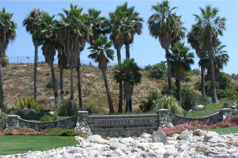
Griffith ParkSpanning across 4,107 acres, Griffith Park is the largest city park in the United States. In fact, the infamous Hollywood sign is actually located within the perimeters of Griffith Park.

There are numerous activities to engage in while visiting Griffith Park. The park is not only home to the Hollywood sign, but also houses the Gene Autry Museum of Western Heritage, Greek Theater, the Griffith Observatory, Los Angeles Zoo, the Travel Town Museum, the Griffith Park Merry-Go-Round, the Griffith Park Southern Railroad, and Pony Rides. Additionally, Griffith Park also features plentiful horseback riding, hiking trails, and bicycle rentals to enjoy the beautiful scenery first hand.

California’s rugged landscaping provides for a fantastic hiking experience. As you traverse through Griffith Park, you'll encounter many of the native California animals, such as quail, deer, and coyotes. Caution is advised however, since you may also cross paths with some rattlesnakes. In total, there are over 53 miles of trails and paths that are perfect for enjoying a short brisk walk, or a more strenuous hike. The trails are open from dawn until dusk and you can pick up trail maps at the Ranger Station.

In addition to hiking, many people enjoy horseback riding at Griffith Park. There are also pony rides available so families of all ages may enjoy the fun. There are specially designated trails for the riders, however, if riders choose to dismount, they must stay on the designated trails. Pony rides are available from Tuesday until Sunday between the hours of 10:00 A.M. until 4:00 P.M. There are also covered wagon rides that provide wonderful entertainment for young children. Whether you are on a date or enjoying the park with your family, you'll find plenty of activities to choose from while visiting Griffith Park.
Elysian Park

by Ron

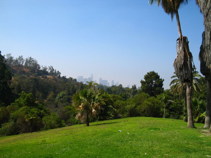
Elysian Park In Los AngelesThe second largest park in Los Angeles is the city's oldest, Elysian Park. Founded in 1781 by the Felipe de Neve, the Spanish California governor, the land originally encompassed over 17,000 acres. Today, the park is situated on 575 acres and is rich with historical sites, hiking trails, and national landmarks.

Since the park is so large, there are numerous activities to engage in. However, many find that the plentiful hiking trails offer some of the most beautiful scenic views throughout all of Los Angeles. There are plenty of picnic areas and barbecue pits in addition to the hiking and walking trails. Some of the features of Elysian Park include the Buena Vista Meadow Picnic Area, the Portola Trail Historical Monument, Solano Canyon where the community garden is located, and the Victory Memorial Grove, where the WWI Memorial is situated).

In addition to the hiking trails, the Elysian Park Therapeutic Recreation Center has outdoor seating and is designed to hold up to 300 people. There is a therapeutic program available for children and teens. There are also several barbecue pits as well as basketball courts and an indoor gym that has weights for working out.

The Montecillo De Leo Politi Park is commonly referred to as the Old Lodge and has many hiking trails as well. Located inside of Elysian Park, Montecillo De Leo Politi Park is open Monday through Friday from dawn to 3:00 P.M. Saturdays and Sundays, it is open from Dawn to Dusk. You'll find plenty of barbecue pits and picnic tables for your family events, but it is best to make reservations beforehand. They also have unlighted tennis courts. To make reservations for park use call: (213) 485-1310.

Barnsdall Art Park

by Ron

Los Angeles Municipal Art GalleryLocated in the heart of Los Angeles is a wonderful resource that helps foster an appreciation and deeper understanding of art, Barnsdall Art Park. The Barnsdall Art Park features international art displays and exhibits, as well as resources to strengthen the community's knowledge of art, and also houses the famous Hollyhock House, which was designed for Aline Barnsdall by Frank Lloyd Wright.
Things To See

When visiting Barnsdall Art Park there are four major features that you will want to enjoy. First, is the unique view of Hollywood, including a fantastic view of the landmark Hollywood sign. The Park is located on Olive Hill and is situated at the intersection of Hollywood and Vermont.

The second site is the Hollyhock House that was built between 1919 and 1923 by Frank Lloyd Wright for Aline Barnsdall. There are scheduled times that you may take guided tours of the home. For parties larger than ten people, reservations are recommended. Tours are available from Wednesday through Sunday at 12:30, 1:30, and 3:30 Pacific Times. Tickets for students and seniors cost $3.00 and adults cost $7.00. Children twelve years and under are free. It should also be mentioned that there is no photography allowed throughout the tours.

During your visit, you'll also want to see the Los Angeles Municipal Art Gallery and the Barnsdall Gallery Theater. The Los Angeles Municipal Art Gallery features many works of art by both local and international artists. The Barnsdall Gallery Theater features a number of theater groups and showcases live performances.

Classes & Art Workshops

The Barnsdall Art Pak is operated by the Community Arts Division of the Cultural Affairs Department. They also offer many art programs as well as workshops. In addition to these regular classes, the Junior Arts Center provides community art resources for children and youth. For more information or to find out the current list of workshops, visit: http://www.barnsdallart.com

Hiking In Solstice Canyon

by Ron

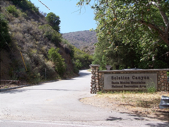
Entrance To Solstice CanyonNestled in the heart of Malibu, in the Santa Monica Mountains, lies a treasure waiting to be explored. The hiking trails in Solstice Canyon are the true star of Hollywood. With breathtaking scenic views of waterfalls, indigenous flora and fauna, a stream that flows year round, and numerous majestic Oaks, Alder, and Sycamore trees, the Solstice Canyon Park is great any time of year.

The canyons are a beautiful way to observe nature in all of her glory. It isn't uncommon to see animals such as deer, bobcats, quail, and mountain lions. There are over 45 mammal species that call the Solstice Canyon home, and over 380 bird species. The streams and lagoons are home to fish that are indigenous to the mountains, and are plentiful year round.

First opened as a public park in 1988, by the Santa Monica Mountains Conservancy, today they are under the management of the National Park Service. With five hiking trails that range from easy to strenuous, Solstice Canyon is revered as one of California's national treasures.

Getting Here

Getting to Solstice Canyon is quite simple. Travel along Pacific Coast Highway until you reach Corral Canyon Road. Turning on Corral Canyon Road, you'll see a large white fence with a gate off to the left side. Once you enter the park you will pay for parking, so inquire about direct routes to the trail you are looking for.

Solstice Canyon has five trails designated for hikers. Three of these trails are deemed easy and are great for the novice hiker or for those who just want to enjoy a leisurely scenic hike.

Dry Canyon Trail

Easy (1.2 miles): This trail is a great hike for the novice hiker. You'll enjoy viewing the 150-foot waterfall at the end of your journey. Be sure to bring plenty of water for your journey, and don't drink the water in streams, as they are not deemed suitable for drinking. When hiking, remember that you must always yield the right of way to horseback riders.

TRW Loop Trail

Easy (1.5 miles): The TRW Trail is a nice gentle hike. While on your journey you will pass through many oak trees. Keep an eye out for woodpeckers, the Peregrine Falcon, and the Red Tailed Hawk. There are also a number of snakes that are indigenous to the region, so it is best to avoid snakes, as the Southern Pacific Rattlesnake is venomous. Fortunately, it is the only venomous snake that lives in the Santa Monica Mountains.

Solstice Canyon Trail

Easy (2.1 miles): When hiking through the Solstice Canyon Trail be sure to keep a watchful eye out for the famed, Keller House. This is an excellent way to view some of Malibu's past history. If hiking with dogs, the dog must remain on a leash at all times, and they are only allowed on trails as well as access roads.

Rising Sun Trail

Moderate (3 miles): It is believed that this trail derives its name from a winery that was founded by Matthew Keller during the later 1800's. You'll enjoy the scenic views of the ocean while hiking along this trail.

Sostomo Trail/ Deer Valley Loop

Moderate/Strenuous (7 miles) This trail is the most strenuous and should be tackled by the seasoned hiker. This trail is beautiful and provides a breathtaking scenic view of the Pacific Ocean.

Will Rogers State Historic Park

by Ron

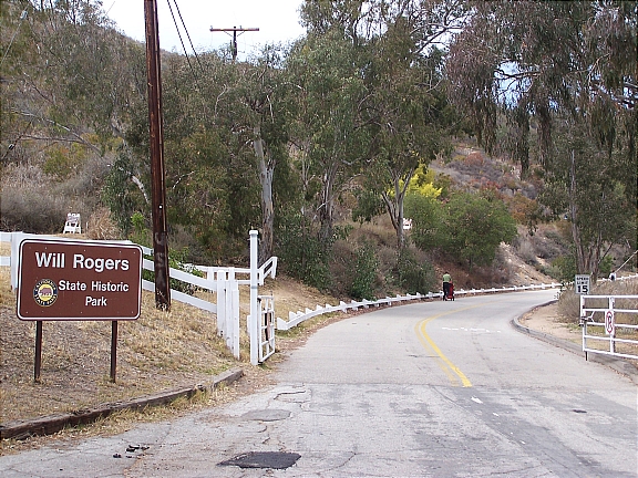
Will Rogers State Historic Park - EntranceLocated in the Pacific Palisades, Will Rogers State Historic Park is one of Los Angeles’s best kept secrets. One of the most popular and highest paid actors of his time, Will Rogers purchased this 186-acre property during the 1920’s as a retreat for his friends and family. An avid rider and horse fanatic, Will Rogers built an expansive ranch which included a 31-room ranch house, stable, corrals, riding ring, and a polo field. In 1935, Will Rogers was the victim of a tragic plane crash, and following his wife’s death in 1944, the ranch was converted into a State Park.

One of the most popular activities to enjoy at Will Rogers State Historic Park is hiking. Take the easy/moderate 3-mile trail loop up to Inspiration Point where you’ll be able to enjoy breathtaking views of downtown Los Angeles, Santa Monica, and the Pacific Coast. If you’re looking for something a little more challenging, head up along the Backbone Trail into the Santa Monica Mountain. The trail offers a fantastic opportunity for mountain biking, horseback riding (BYOH – Bring Your Own Horse), and hiking – leading you as far as Point Mugu State Park in Malibu.

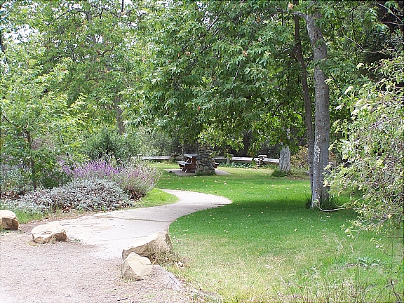
Will Rogers State Park is also popular for picnicking – there is tons of green space available for you to set up and enjoy picnic (first picture below).

For something completely different, head up to the park on the weekends for an exciting polo match. The polo field (second picture below) is the only regulation size field in Los Angeles County; in fact, it’s the only polo field period. During the season (April through October), the Will Rogers Polo Club holds matches on Saturday – from 2pm to 5pm, and Sunday – from 10am to 1pm. The matches are absolutely free to the public, so if you’ve never seen a game of polo in person, make sure to come by and check it out.

Getting Here

Getting to the park is quite simple. Take Sunset Blvd westbound towards Pacific Palisades and make a right on Will Rogers State Park Rd. You’ll take the road for about half a mile until you reach the park entrance. Entrance to the park is free but there is a $7 fee for parking.

Piuma Lookout In Malibu: Part 2

by Ron

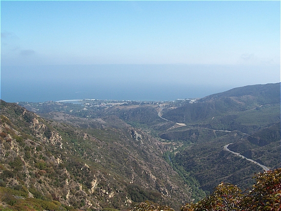
View From The Overlook The last overlook I covered along Piuma Rd in Malibu (Piuma Lookout: Part 1) was pretty easy to access and couldn’t be missed. The lookout had a couple picnic tables and a breathtaking panoramic view of the canyons. Now if you’re looking for something a little more secluded and want to get a glimpse of the Pacific Coastline, head a little further down Piuma Rd till you see a short trail that leads off the road (first picture below).

You can park your car along Piuma Rd (make sure you’re not actually on the road) and make your way up the hill. It’s a little steep and there are rocks so you’ll want to wear some comfortable shoes that you wouldn’t mind getting dirty. Although it may look difficult, it’s really not that bad getting up there…just be careful and watch your step.

Once you reach the top of the hill there will be a small dirt area where you can enjoy the view (second picture below). If you want to hang out there for a while, bring along a blanket and lay it out on the ground. Although you’re not trespassing and there are no signs prohibiting it, I can’t be certain that you’re allowed up there – so just keep that in mind before you go.

Notice: PlanJam is not responsible for any injuries and/or fines that may be incurred. If you decide to go up there…you do so at your own risk.

Piuma Lookout In Malibu: Part 1

by Ron

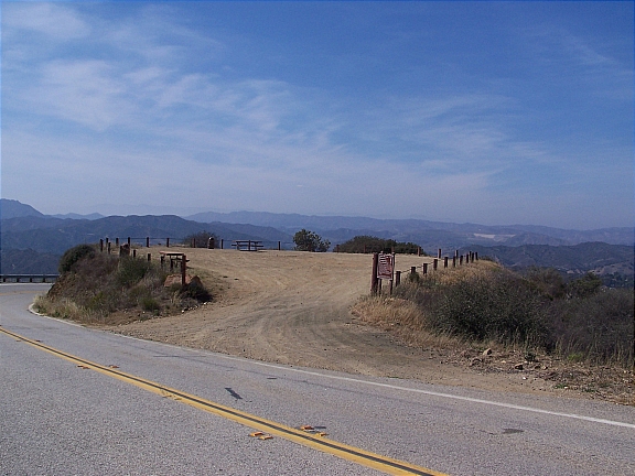
Piuma Overlook In MalibuIf you’re in the mood for a little drive, head up along Piuma Rd in Malibu for a breathtaking experience. The drive up to the lookout is exceptionally charming; you’ll enjoy picturesque views of the Pacific Coastline as you traverse the windy road. There are quite a few spots along Piuma Rd to take in a view, but there are two that I am particularly fond of. The first one, which will be discussed in this post, is a large dirt area overlooking the canyons. The other spot is a little more secluded and does require a little more effort to get to.

Once you reach the overlook, you can park your car on the dirt area. There are two large picnic tables available so feel free to bring along some food or even a board game. I strongly suggest that you take a warm sweater or coat with you because it does tend to get a little breezy up there.

Getting Here

You can get to the overlook from either Calabasas or Malibu. If you’re headed from Malibu, travel eastbound along Malibu Canyon Rd and make a right on Piuma Rd. Alternatively, if you’re coming from Calabasas, go westbound along Las Virgenes Rd and make a left on Piuma Rd.

Once you’re on Piuma Rd, you’ll drive for about 10 minutes until you reach a large dirt area which overlooks the canyons. Since there are no cross-streets on the way up, you’ll have to just keep your eyes open. The overlook will be on your left side as you come around the bend (click here for a map) and you’ll also be able to see it above you as you’re coming up Piuma Rd.

Temescal Gateway Park

by Ron

Temescal Gateway Park - Pacific PalisadesLocated in the Pacific Palisades, Temescal Gateway Park covers over 140-acres of terrain and is one of the most popular of the Santa Monica Mountain parks. The park offers ample opportunities for picnicking, panoramic views of the coastline, large grassy areas, and access several hiking trails that range from easy to moderate difficulty. You can also access additional hiking trails into Topanga State Park and Will Rogers State Historic Park.

Parking is available at the park entrance for $5 per day. The parking lot is a haven for parking enforcement so make sure that you follow all the rules. Also, make sure to watch your speed and come to a complete stop when necessary; the forest rangers are always on the prowl and they won’t hesitate to give you a citation. By the way, failure to come to a “complete” stop will run you about $100 (this comes from experience).

Alternatively, you can skip the parking fee and park along Temescal Canyon Rd or Sunset Blvd for free; just make sure to read the signs before heading up to the park. Also, if you’re coming here for the hike, make sure that you bring plenty of water along with you…there are no water fountains along the trails.

Getting Here

Getting to Temescal Gateway Park is really simple. If you’re taking PCH, turn onto Temescal Canyon Rd and head up about 1 mile until you reach Sunset Blvd…the park will be directly in front of you. If you’re taking the streets and are headed westbound along Sunset Blvd, you’ll make a right turn into the park at Temescal Canyon Rd.

San Vicente Mountain Park

by Ron

Located in the eastern portion of the Santa Monica Mountains, the 10-acre San Vicente Mountain Park offers access to an expansive network of trails for hiking and mountain biking, several picnic areas, and breathtaking 360-degree views of the city.

Interestingly enough, San Vicente Mountain Park was once used as a missile launch site during the Cold War (from 1956-1968). That explains the Nike-Ajax anti-aircraft structure and radar tower; both are no longer operational but the radar tower is an excellent spot from which you can enjoy a spectacular sunset.

Getting Here

Getting to the park is fairly simple. If you’re taking the freeway, take the 405 North and exit on Skirball Center Dr. Turn left onto Skirball Center Dr and then make another left on Mulholland Dr. As you’re heading east along Mulholland Dr, you’ll notice a dirt road on your left side…turn onto that road and head up the unpaved trail. The physical address is 17500 Mulholland Dr, but the nearest cross street to the park entrance is Canyonback Rd.

You can either park your car immediately on the right or continue a little further till you reach the parking lot. Once you park your car, there is a short 10-minute walk up to the park along a wide dirt road.

Note: The unpaved road is extremely bumpy and there are tons of rocks. If you have low profile tires, there is a chance that you may damage them.

Nancy Hoover Pohl Overlook: Mulholland Dr

by Ron

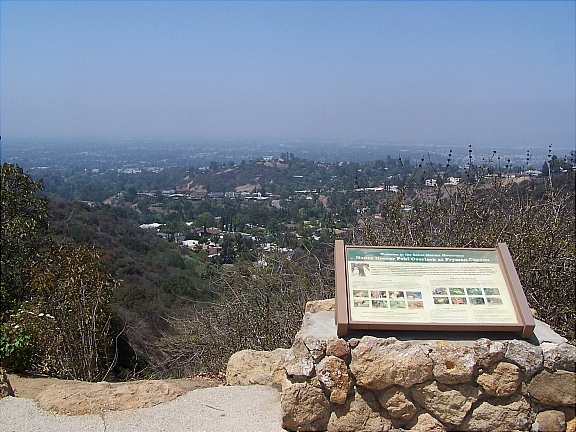
Nancy Hoover Pohl Overlook - Studio CityEnjoy a fantastic view of the San Fernando Valley from the Nancy Hoover Pohl Overlook in Studio City. This scenic viewpoint is located on the north side of Mulholland Dr along the Mulholland Scenic Parkway. The overlook has its own parking lot, physical fitness course, and provides access to several hiking trails through Fryman Canyon – including the five-mile Betty Dearing Mountain Trail.